The history of KOPA-company
Company
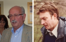
In 1966, the surveying office was founded by the two engineering consultants for surveying HR. Dipl.-Ing. Erich Korschineck and Prof. Dipl.-Ing. Dr.techn. Kornelius Peters † (short form KOPE). After more than 30 years of successful work the office with 22 employees at that time was completely taken over by the Korschineck & Partner ZT-OEG (short form KOPA) on April 01.1999.
In 2006 the Korschineck & Partner ZT-OEG was finally reorganized to the Korschineck & Partner Vermessung ZT-GmbH of the managing directors and state authorized engineering consulants for surveying Dipl.-Ing. Dr.techn. Florian Helm, Dipl.-Ing. Johann Liebert and Dipl.-Ing. Christian Supper.
From April 01.2013 KOPA and the civil engineering office of Dipl.-Ing. Friedrich Reichhart formed the permanent working comunity ARGE REICHHART - KOPA Vermessung. After the retirement of DI. Reichhart in 2015 the brand REKO is preserved to the continuation of existing orders as well as for the realisation of follow-up orders.
KOPA currently occupies 35 full-time employees (plus 3 COE). We can cover with a graduate´s rate from more than 1/3 as well as a modern equipment in the sector of hard and software nearly the whole measurement spectrum and offer qualitatively high archievements. The size of our office enables us to guarantee a flexible and fast transaction of the orders.
As a result we can handle in Austria and especially in the metropolitan area of Vienna even more efficiently your surveying duties.
Technical Development
- 1968: first desktop computer Olivetti P101
- 1976: first electronic distance measuring device Wild DI3S
- 1980: first drum plotter
- since 1991: plan production in CAD
- 1999: first use of a Total station whitout reflector Leica TCR 1101
- 2002: use of the GPS/GNSS-technology for static measurement traverse and RTK-point collection
- 2002: first use of a Geomonitoring-system on base of two independently measuring digital levels
- 2006: development of the 3D-Geomonitoring-system GMS.NeVi together with Intermetric/Stuttgart
- 2009: establishment of a software development department(Products, KOREM.Net, GMS.GUI, KOPA.Suite,…)
- 2010: purchase of the first laser scanner Faro Photon for architecture- and tunnel survey
- 2012: firtst integration of the GPS/GNSS-technology in a permanent Monitoring System for extensive terrain surveillance
- 2016: object surveying for BIM-models (Building Information Modelling)
Main Projects
- 1978-1986: Allgemeines Krankenhaus Wien – AKH
Correction of the land register, network measurement, setting out, control surveys - since 1980: Wiener Lokalbahnen – Badner Bahn
Construction surveyig management (route plan, detail recording, cadastre- and boundary surveying, setting out) - since 1986: Wiener Linien - U-Bahn-Bau (U1/3, U1/4, U2/3, U2/9, U3/10, U3/11, U3/14, U3/18, U6/11, U6/16) construction surveying management
- 1991-2015: Lainzer Tunnel
Construction surveying management at part LT21, LT22, LT23, LT31, LT32, LT33, LT34 and LT43; basic surveying, land aquisition plans, network measurement, geotedical measurements, geomonitoring, main control survey, final documentation - since 1999: Verbund – Austrian Power Grid
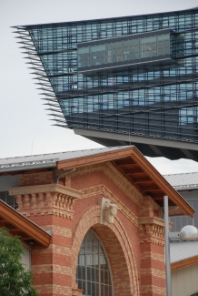
basic surveying, airborne laserscan, orthophotos, topographic mapping, CAD-plan development for alignement and power line documentation projects. - since 2001: Stadtentwicklungsgebiet Wien - St. Marx
surveying support of the estate development for the purpose of settlement of office- and industrial concerns - since 2011: Tunnelkette Bataszek, motorway M6, Hungary first use of GMS.NeVi outside Austria
- since 2011: Brenner Basistunnel
tunnel survey for the parts Ampass and Wolf geotechnical and deformation measurement, main control - since 2013: Pottendorfer Linie - Lower Austria
basic surveying, network measurement, correction of the land register, construction surveying management, control measurements

right: Dipl.-Ing. Johann Liebert

right: Dipl.-Ing. Dr.techn. Kornelius Peters†


in the urban developmet area St. Marx; Surveying services by KOPA

